The activities developed by the researchers and students of the MASSA group are currently being carried out in three different research sites located in the Curu Watersheds and in the High Jaguaribe.
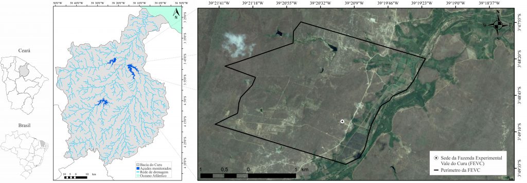
SITE I Located in the Fazenda Experimental Vale do Curu (FEVC), property owned by the Universidade Federal do Ceará (UFC) in Pentecoste county (Figure 1), this site is composed of five fragments, as follows: a microwatershed where research on surface runoff and nutrient loss is carried out and four other fragments for research on land use and occupation – Caatinga in regeneration, thinned Caatinga, an area for animal grazing and one for agricultural cultivation. In these four fragments, aspects related to storage of biomass and carbon in the Caatinga Biome are researched with the aim of quantifying the amount of storage in the soil use and occupation regimes cited above.
Figure 1 – Location of Site I – Fazenda Experimental do Vale do Curu – FEVC
The climate of the region is of type BSw’h’ (Hot semiarid), with main monthly temperatures always superior to 18 ºC. Rainfall presents a unimodal distribution, starting in February/March and ending in June, with peak occurences in March and April. The annual rainfall average stays around the isohyet of 700 mm. The monthly distribution is marked by a high temporal and spatial variability, being able of having in one month an amount of rainfall superior to the annual total of a dry year.
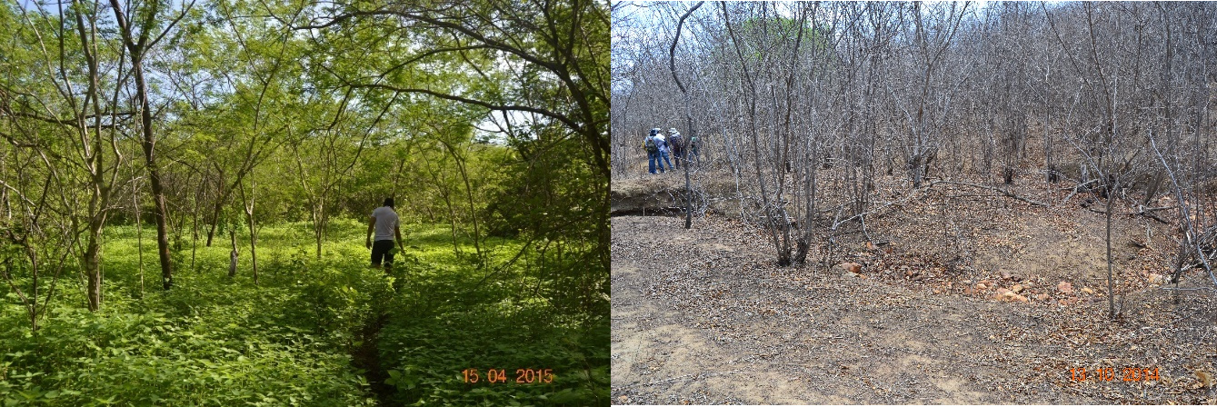
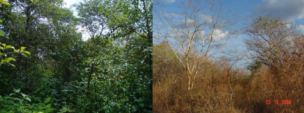
The vegetation coverage of the native area is composed predominantly by Sebastiana macrocarpa Mull. Arg. (Sebastiana), Bauhinia cheliantha (Bong) Steud (Mororó) and Piptadenia stipulacea (Willd.) Poir. (Jurema branca). The vegetation coverage of the area under animal grazing is constituted mainly by Croton blanchetianus Bail. (Marmeleiro) (Figure 2). The cultivation areas are composed almost completely by corn and grass.
Figure 2 – Fregment of thinned caatinga in the FEVC during the rainy and dry seasons
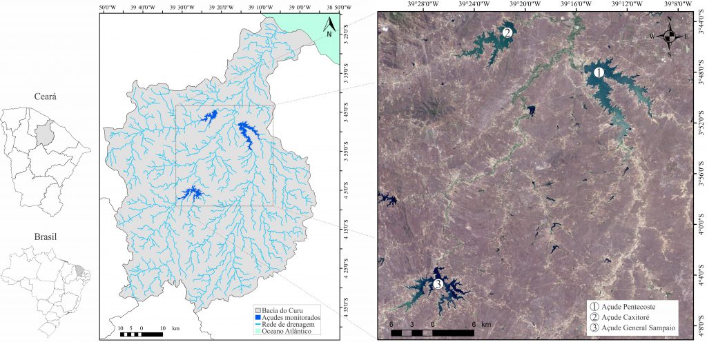
SITE II Public reservoirs of the Curu Watershed: study area composed by the Pereira de Miranda, General Sampaio and Caxitoré reservoirs. In these areas, physical/chemical/biological indicators are researched as support for a water quality monitoring model using remote sensoring as well as the amount of carbon deposited during sedimentation process.
Figure 3 – – Location do Site II – Strategic reservoirs of the Curu Watershed
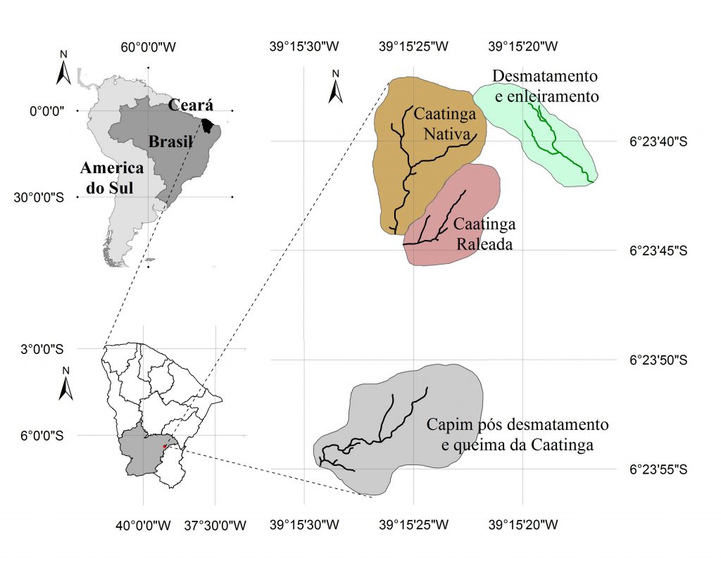
SITE III The site is composed of four microwatersheds that represent the Caatinga Biome, where an identification and quantification of the sustainable management of the natural capital in distinct soil uses is researched. These microwatersheds are located in Iguatu county, inserted in the High Jaguaribe watershed. The area is managed by the Instituto Federal de Educação, Ciência e Tecnologia do Ceará (IFCE) – Iguatu Campus (Figure 4).
The climate of the region is of type BSw’h’ (Hot semiarid), with main monthly temperatures always superior to 18 ºC. Rainfall presents a unimodal distribution, starting in January and ending in May, with annual rainfall average of 863 mm. It is a concentrated regime, where, on average, about 60% of the total annual rainfall occurs in March and April. The monthly distribution is characterized by a high temporal and spatial variability, where the rainfall depth of a single month can exceed the total annual rainfall depth of a dry year.
Figure 4 – Location of Site 3 – Experimental Microwatersheds in Iguatu – 6°23’43”S; 39°16’29”W
The vegetation coverage of the area is composed of a trees and a herbaceous extract (Figure 5). Among the tree species present, there is a predominance of the Aspidosperma pyrifolium Mart (pereiro), Anadenanthera macrocarpa (angico) and Croton sonderianus Muell.Arg (marmeleiro). As for the herbaceous extract, it is formed mainly of Hyptis sauaviolens (L.) point (banbural), Hyptis sp. (melosa) and Cróton sp. (velame).
Figure 5 – The Caatinga during rainy and dry seasons